
Mohave
Desert
|
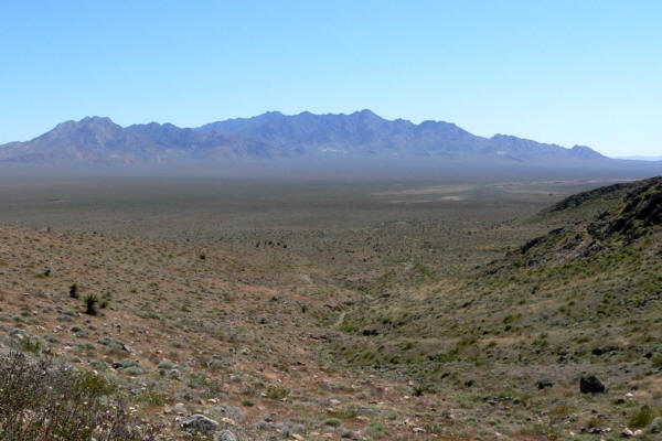
The Mojave or Mohave
Desert occupies a significant portion of Southern California and parts
of Utah, Nevada and Arizona. Named after the Mohave tribe of Native
Americans, it occupies over 22,000 mi² (35,000 km²) in a typical Basin
and Range topography. The Mojave Desert is bounded in part by the Tehachapi
together with the San Gabriel and San Bernadino mountain ranges. The
mountain boundaries are quite distinct since they are outlined by the
two largest faults in California: the San Andreas and the Garlock. Its
northern and eastern boundaries are less distinct. One way to determine
entry is by observing the presence of Joshua Trees. The Mojave, like all deserts in general, is known for its summer heat; however, much less renowned is the Mojave's wintertime cold. Snow, although uncommon, does fall in parts of the Mojave. Amounts range from just a trace to a foot or more of heavy wet snow which can lead to freeway traffic closures and being "snowed in". The coldest wintertime temperature ranges have been below freezing yet above 0°F. That said, many parts of the Mojave typically range from highs of around 95–105°F in the summer to lows of around 20–30°F in the winter. Wind is also a weather factor. Las Vegas, situated on the desert's east, may not have many winds, but the community of Mojave, situated at its western end, can have wind nearly every day — even winds surpassing fifty miles per hour. Nearby Tehachapi Pass, due to the high likelihood of reliable wind, is home to an extensive electrical Wind turbine "Wind farm" which converts wind, a renewable-clean-resource, into electricity. The Mojave Desert contains a number of ghost towns, the most significant of these being the silver-mining town of Calico, California and the old railroad depot of Kelso. Some of the other ghost towns are of the more modern variety, created when Route 66 (and the lesser-known US Highway 91) were abandoned in favor of the Interstates. The Mojave Desert is crossed by major highways Interstate 15, Interstate 40, US Highway 395 and US Highway 95. Among the more popular and unique tourist attractions in the Mojave is the self described World's Largest Thermometer at 135 feet high, reportedly also the highest °F temperature ever recorded in the region, which is located along Interstate 15 in Baker, California. Kelso Dunes is also a popular recreation spot. The Mojave River is an important source of water in this arid land. A part of the Colorado River also traverses its far eastern portion. The Mojave Desert is not entirely rural as a few cities do exist there. Las Vegas, Nevada is the Mojave's largest city and metropolitan area. Palmdale is the largest city by population on the California side of the desert and is part of the Lancaster/Palmdale Urbanized Area, a U.S. Census Bureau defined term. Other incorporated cities include; Henderson, North Las Vegas, and Laughlin in Nevada, and Victorville, Barstow, Ridgecrest, and Needles in California. Angelenos often refer to its southwestern portions, the Antelope Valley and the Victor Valley, as the High Desert.
|