*** SOLD ***
Copper Canyon Ranch
Yavapai County, Arizona
Pictures
Please click on any of the pictures
for a larger view
|
|
|
|
|
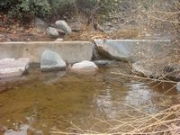
[1] Water in Copper Canyon Creek |
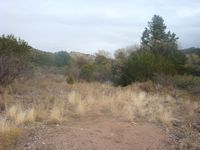
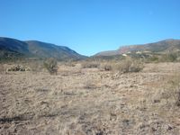
[2] Typical rangeland |
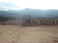
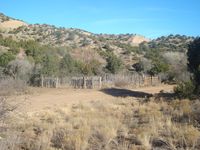
[3] Lucky Canyon shipping corrals |
|
|
|
|
|
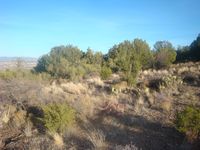
[4] Rangeland near Gaddis Canyon Well |
[5] Looking down on Lucky Canyon Corrals |
[6] |
|
|
- |
- |
|
[7] Corrals in Copper Canyon |
- |
- |
Location
& Maps
|
|
|
|
|
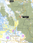
Location
map |
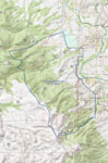
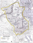
Topo Map |
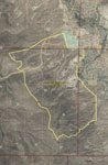
Aerial Map USFS |
USFS prepared allotment map |
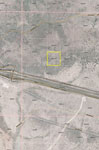
Aerial deeded |
Location
The Copper Canyon Ranch is located southwest of Camp Verde in Yavapai County, Arizona. Interstate 17 runs through the northwest portion of the ranch.
Land Tenure
Carrying Capacity
100 Animal Units; or 93 AU’s and seven head of horses.
Description
The Copper Canyon Allotment on the Prescott National Forest sits southwest of Camp Verde and is bisected by I-17 and General Crook Trail. The ranch is fenced exteriorly and interiorly into 5 main rotational pastures and three smaller pastures. Topography is flat to rolling on the north and eastern portions of the allotment along Salt Mine Road and gets steeper as the allotment goes to the west in the Black Hills. Elevation ranges from 3,100’ to 6,000’.
Vegetation is a mix of plains and desert grassland with browse, perennials such as tabosa, side oats and black gramma grass, bush muley and curly mesquite are common in the area. Browse includes mesquite, turbinella oak (scrub oak) and mountain mahogony.
The base/commensurate property is not located within the allotment and consists of 10.22 acres located west of Ash Fork.
Water
Water on the ranch is provided by several springs, seeps, Copper Canyon Creek and earthen tanks. There is a well (Gaddis Canyon) with a submersible in the Monroe pasture on the north end of the allotment that is shared with the Verde allotment. In addition, water is hauled to a few selected locations on the allotment.
Corrals
There are two corrals on the allotment. The main shipping corrals are located at Lucky Canyon ¼ mile west of Salt Mine Road. The other set is located in the Thompkins pasture along Copper Canyon Creek.
Utilities
None. A generator is required at Gaddis Canyon Well.
Grazing Fees & Taxes
Grazing fees for 2016 are $2.11/AUM and is based on actual use. 2015 property taxes for the base land was $200.58.
Comments
The Copper Canyon Ranch is a grazing allotment on the Verde Ranger District of the Prescott National Forest. This is a good forest grazing allotment that is located adjacent to Camp Verde. The base (commensurate) property is not located within the ranch. It is located near the I-40 & Crookton Road/Rte 66 intersection (Exit 139) west of Ash Fork. No livestock or equipment is included.
Price
$199,000, cash. Submit all offers.
Printable
Brochure
 Please click here to download (about
1.5mb) a printable brochure in Adobe Acrobat format. If you get
frustrated trying to make this work on your computer, don't hesitate
to ask us to mail you a printed and bound brochure instead.
Please click here to download (about
1.5mb) a printable brochure in Adobe Acrobat format. If you get
frustrated trying to make this work on your computer, don't hesitate
to ask us to mail you a printed and bound brochure instead.