Pictures
Please click on any of the pictures
for a larger view
 |
 |
 |
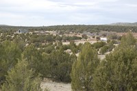
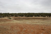
[10] Overview of deeded |
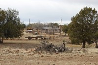
[11] Overview of Headquarters |
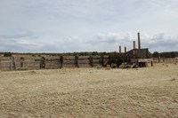
[12]Shipping corrals |
|
|
|
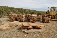
[4] Flagstone quarry on deeded |
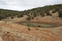
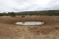
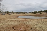
[5] Forest tank |
[6] Forest tank |
|
|
|
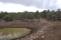
[7] Forest tank |
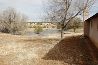
[8] House tank |
[9] Main house |
|
|
|
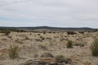
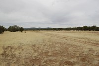
[13] Summer range |
[14] Summer range |
[15] Summer range |
|
|
|
[16] Summer range |
[17] Summer tank |
[18] Summer tank |
|
|
|
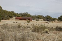
[19] Typical storage tanks |
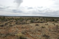
[20] Winter range |
[21] Winter range |
|
|
|
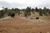
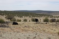
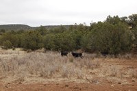
[1] Cows |
[2] Cows |
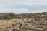
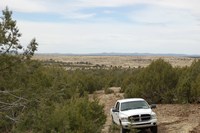
[3] Deeded land w/ view of San Francisco Peaks |
|
|
|
Location & Access
Please click on any of the maps
for a larger view
|
|
|
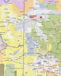
General
location in AZ |
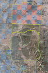
Topography
map |
Aerial map |
The Gold Trap Ranch is located 6 miles due north of Ash Fork, Arizona and Interstate 40. Part of the ranch lies within the Kaibab National Forest with the remainder located on adjacent lands to the north. Paradise Ridge lies to the east of the forest permit and the Atchison Topeka and Santa Fe Railroad runs through the middle of the forest permit. Access is provided by Interstate 40 to Ash Fork and forest road 142, 6 miles north the ranch boundary and 6 additional miles to the ranch headquarters. Many small dirt roads provide access to the interior of the ranch.
Property Description
The ranch is divided into two contiguous units, summer and winter range. The forest permit is allocated for 225 adult cattle from October 15 to April 15 (6 months). The state lease and deeded range land is used as summer pasture. The headquarter improvements are located along forest road 142 within the National Forest Boundary. Other improvements include perimeter and interior cross fencing. Topography is tree covered rolling hills and mesas to open valleys.
Land Tenure |
Acres |
Sections |
% of Total |
| Deeded Range Land |
7,603 |
11.9 |
18.76% |
| Deeded Forest Land |
343.8 |
10.5 |
1.00% |
| State Lease |
8,582.4 |
13.4 |
21.00% |
| Forest Permit |
25,725.0 |
37.5 |
60.00% |
| Total Ranch |
42,452.2 |
63.3 |
100.00% |
Assessor’s Parcel Numbers: 700-32-002, 205-04-003 & 205-04-001
Arizona State Grazing Lease: No.: 05-144
US Forest Service: Partridge Creek Allotment in the Kaibab National Forest
Carrying Capacity
75 animal units yearlong Deeded
80 animal units yearlong State
112 animal units yearlong (equivalent) Forest Service*
267 animal units yearlong (equivalent) Total
*The Forest Allotment is allotted for 225 AU from October 15 to April 15 (winter use only).
Above numbers based on State and Forest Service actual rated capacity. Deeded carrying capacity based on State rated capacity of 6 head per section.
Water
Domestic water at the headquarters is hauled from Ash Fork to a 5,000-gallon storage tank. Livestock water is supplied by dirt tanks, which fill from Partridge Creek during times of runoff. Additional livestock water is supplied by numerous dirt tanks located throughout the ranch. Several storage tanks and drinkers are on the ranch allowing water to be hauled in on dry years.
Soils
Deama-Tovar-Toqui: Very shallow to moderately deep, well drained, nearly level to very steep soils; on hillsides, plateaus, and mesas.
Ashfork-Thunderbird-Springerville: Moderately deep, well drained, nearly level to very steep soils; on hillsides and fan terraces and in basins.
Vegetation
Plains & Desert Grassland natural vegetative community and Piñon-Juniper Woodland.
Elevation
Ranges from 5,200 to 6,200 feet with the headquarters situated a 5,460 feet. The majority of the deeded range land lies between 5,200 and 5,700 feet.
Climate
Ranch average annual precipitation is 13.38 inches per year.
Average Temperature – at Ash Fork:
Month |
Maximum |
Minimum |
| January |
52.6 |
21.0 |
| July |
91.8 |
56.1 |
The closest U.S. Weather Bureau Reporting Station having complete records for the area Ash Fork, Arizona. These records were taken from the Climatological Summary in Arizona Climate 1931-1972 edited by William D. Sellers and Richard H. Hill.
Utilities
The headquarters has Arizona Public Service electricity. Telephone is available by cell service and propane is used for cooking and heating.
Zoning
All deeded parcels are located in unincorporated areas of Coconino County and are zoned: Coconino County General 10-acre minimum. This is a common zoning for ranching and agricultural properties.
Flood Zone
Headquarters Deeded: Zone A, approx. 20%; Zone C, approx. 80%. Deeded Range Land: Zone C, except for natural drainage areas which are Zone A.
Taxes
Year 2015 (estimated) $1,089.18
Grazing Fees
$1.35 per AUM federal grazing lease (2014)
$2.78 per AUM state grazing lease (2014)
Improvements
The headquarter improvements include a 2,156 SF main ranch house, a 790 SF house in poor condition, a 2,122 SF livestock barn, a 1,984 SF equipment barn, working corrals with 15 ton scale and miscellaneous outbuildings.
Range improvements are typical consisting of boundary and cross-fencing. The northern portion or summer country is divided into two pastures and the southern portion or winter country is divided into four main pastures with several traps.
Remarks
The northern portion of the ranch consists of checkerboard style land being intermixed with private and State sections. The majority of the access roads in this area are controlled and have been kept locked for many years giving the owner the ability to control hunting and wood-cutting access. Additionally, the owner has significant areas of marketable flagstone on the ranch.
Price
$3,800,000 – Cash
Printable
Brochure
 Please click here to download (about 3
MB) a printable brochure in Adobe Acrobat format. If you get frustrated
trying to make this work on your computer, don't hesitate to ask us
to mail you a printed and bound brochure instead. Please click here to download (about 3
MB) a printable brochure in Adobe Acrobat format. If you get frustrated
trying to make this work on your computer, don't hesitate to ask us
to mail you a printed and bound brochure instead.
Contact
Offered
for sale exclusively by:
Traegen H. Knight
Headquarters West, Ltd.
PO BOX 1980
St. Johns, AZ 85936
Phone: (928) 524-3740, Fax: (928) 563-7004, Cell: (602) 228-3494
Email: info@headquarterswest.com
Web: www.headquarterswest.com/goldtrap
Disclaimer: This information was obtained
from sources deemed to be reliable but is not guaranteed by the Broker.
Prospective buyers should check all the facts to their satisfaction.
The property is subject to prior sale, price change, or withdrawal.
|

.jpg)