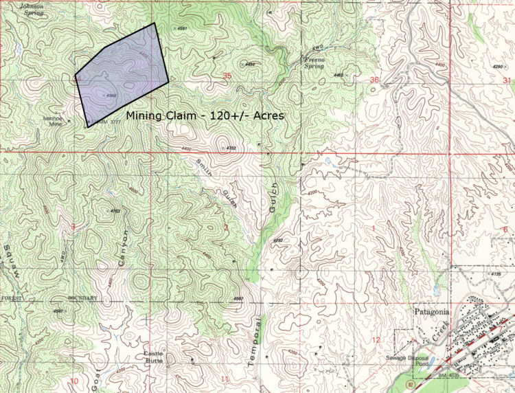
Patagonia
Mining Claim
Topographic Map
Source: USGS
7.5" Patagonia Quadrangle, 1981
The ranch boundaries are approximate in this map.
Note:
if you find it inconvenient to view this map on your computer, please don't
hesitate to
contact us at info@headquarterswest.com - we would be happy to mail you a
printed brochure.
Please click
here or press the "Back" button on your
browser to return to the brochure.