*** SOLD ***
Circle Bar Ranch
Maricopa County, Arizona
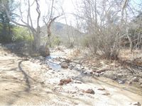
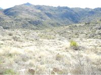
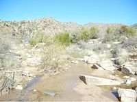
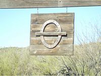
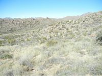
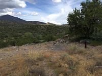
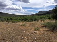
Pictures
Please click on any of the pictures
for a larger view
|
|
|
[1] |
[2] |
[3] |
|
|
|
[4] |
[5] |
[6] |
|
|
|
[7] |
[8] |
[9] |
|
|
|
[10] |
[11] |
[12] |
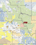
Location
& Maps
Please click on any of the maps
for a larger view
|
|
|
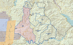
Location map |
Circle Bar Unit Overview |
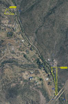
Aerial map of
deeded tracts -
291-05-011Q &
219-05-041B
|
Description
-
The Circle Bar Ranch is located northeast
of Fountain Hills on both sides of S.R. 87,
north of the Salt River and south of
Sunflower, from Four Peaks on the east to
the Fort McDowell Reservation to the west.
-
Fee simple estate in
10.259 acres at Sunflower three mails North of the grazing allotment
-
Leasehold estate in the Sunflower Grazing
Allotment on the Tonto National Forest,
Mesa Ranger District - 525 head ow/calf
year round on 97,885 acres.
-
The ranch's 10.259 acres of deeded land are in the area known as Sunflower. Access is
from Old SR 87 which is a paved road and has a deceleration lane with cross over off the
Beeline Highway. Old SR 87 dead ends at Sunflower.
-
Maricopa County APNs 219-05-011Q and -041B. Zoning is RU-43. There are no utilities
at Sunflower. Custom homes in the neighborhood utilize solar or generators. Sunflower
is outside of the Phoenix AMA.
-
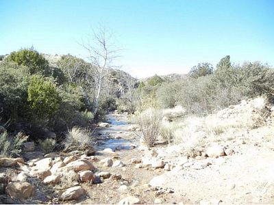
Parcel -041B is 8.43 acres located on Sycamore Creek. The parcel has a drilled
(unequipped) well and has a nice building site for a ranch headquarters overlooking
Sycamore Creek.
-
Parcel -Ol1Q is 1.87 located overlooking Sycamore Creek but does not have frontage on
the creek. The parcel has a drilled (unequipped) well. There is room for one homesite
on this parcel.
-
The elevation of Sunflower is approximately 3,500' and is 32 miles south of Payson and
57 miles northeast of downtown Phoenix.
-
The Sunflower Grazing Allotment is for 525
head cow/calf year long on 97,885 acres.
There are four units within the ranch which
each are rotationally grazed by separate herds.
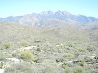
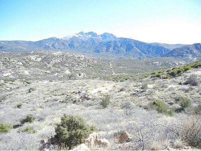
Elevation of the ranch is 1,540’ on the desert to
7,657’ at Brown’s Peak, the northern most peak
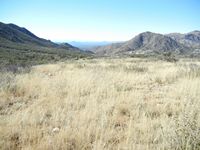
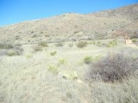
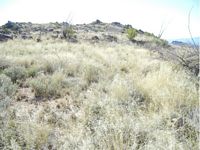
of Four Peaks. Vegetation is extremely diverse
with Sonoran desert scrub, semi-desert
grassland, interior chaparral, pinyon-juniper,
some ponderosa pine and riparian. About 60%
of the annual moisture occurs from December
to March, while most of the balance occurs
during the summer monsoon from July to
September. At the lower elevations 11” of
precipitation is typical, while at the higher
elevations 24” plus snow are common. The
Heber-Reno sheep driveway bisects the ranch.
Also included in the grazing allotment mainly
on the south and west end are 56,724 acres of
non-use (will not currently be grazed) lands.
Initial stocking rates will be lower,
with annual monitoring between the
permittee and the USFS the capacity
will be built up. There is a tremendous
amount of feed on the ranch. Below are
the estimated initial stocking capacity
and subsequent maximum stocking
capacity permitted by the USFS. The
field on the right notes capacity numbers
based on 2014 production data from
monitoring.
Unit |
Estimated Initial Stocking
(cow/calf pairs) |
Maximum Stocking
Upper Limit
(cow/calf pairs) |
Capacity Number Based
on 2014 Production Data
AUM/Number
|
| Cottonwood East |
50-75 |
100-125 |
3,599/300 |
| Cottonwood West |
50-75 |
100-125 |
| Cline |
75-100 |
125-150 |
1,841/153 |
| Dos S |
50-75 |
100-125 |
2,524/201 |
| Total |
225-325 |
425-525 |
7,964/664 |
Unit |
Pastures |
Approximate AUMs |
Proposed AUMs/Unit |
Acreage |
| Cline |
Ballantine
Cline
Mud Springs |
708
714
419
|
900-1,800 |
6,228
5,613
4,307
Total 16,148 |
Cottonwood
Unit West |
Adams
North
South |
283
1,159
550 |
600-1,500 |
2,426
12,469
9,819
Total: 24,714 |
Cottonwood
Unit East |
Alder Creek
Cane Springs N
Can Springs S |
648
388
571 |
600-1,500 |
11,051
5,167
10,822
Total: 27,040 |
| Dos |
Maverick
Picadilla
Pine Creek |
567
1,089
868 |
600-1,500 |
5,296
11,205
13,482
Total: 29,983 |
| Totals |
|
7,964 |
2,700-6,300 |
97,885 |
Above is the carrying capacity per unit and
per pasture along with acreages.
-
To view the Final Environmental Assessment
for the Sunflower Allotment click here
-
To view the signed Decision Notice and
Finding of No Significant Impact authorizing
grazing for the Sunflower Allotment click here.
-
Initial stocking will not occur until all
existing water developments and all new/existing fences are
functional and maintained. Several new areas of fence will
be required (for new Ballantine pasture and splitting
Cottonwood East/West), while typical maintenance on
existing fences will be needed. Corrals throughout the
ranch need to be rebuilt and/or maintained. Improvements can be completed by unit and then stocking can occur in that unit, rather than the entire ranch at one time. There is a lot
of natural barrier boundary within the ranch which will be
used for the new grazing system on the ranch, cattle in the
four units will need to be ear tagged with different color
tags to ensure cattle drift between the units does not occur.
Areas of the south and west ends of the ranch have heavy
recreational use, the heaviest areas of recreational use are
in the non-use area of the ranch. Also within the non-use
area is Sonoran Desert tortoise habitat. As of early 2016 the USFS has issued an Allotment Management Plan and the Term Grazing Permit.
The Circle Bar Ranch has been in the same family for over 100 years. With the diverse vegetation and size of the
ranch, this is one of the larger sized ranches that is actually capable of running this amount of livestock. The ranch conveys with 100% of
whatever mineral or water rights the seller actually owns. The seller and broker make no representation as to the quantity or quality of
any mineral, other sub-surface or water rights appurtenant to the property. The information provided herein was btained from sources
deemed reliable but is not guaranteed by the broker. Prospective buyers should check all the facts to their satisfaction. The property is
subject to prior sale, price change or withdrawal.
Price
$700,000
Printable
Brochure
 Please click here to download (about 3 MB) a printable brochure in Adobe Acrobat format. If you get frustrated
trying to make this work on your computer, don't hesitate to ask us
to mail you a printed and bound brochure instead. Please click here to download (about 3 MB) a printable brochure in Adobe Acrobat format. If you get frustrated
trying to make this work on your computer, don't hesitate to ask us
to mail you a printed and bound brochure instead.
Contact
Paul Groseta
Headquarters West, Ltd.
51 Verde Heights Drive, Suite A
P.O. Box 1840
Cottonwood, Arizona 86326
Phone: (928) 634-8110; Fax (928) 634-2113; Mobile: (928) 853-8369
Email: paul@headquarterswest.com
Web: www.headquarterswest.com/circlebar
Disclaimer:
This information was obtained from sources deemed to be reliable but
is not guaranteed by the Broker. Prospective buyers should check all
the facts to their satisfaction. The property is subject to prior
sale, price change, or withdrawal.
|