Satellite
Image
Source:
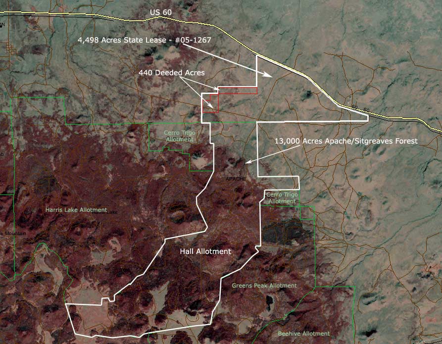
Landsat Enhanced Thematic Mapper Plus, false color composite - 1999. The ranch
boundaries are approximate in this map.
Please click here or press the "Back" button
on your browser to return to the brochure.
Disclaimer: This information was obtained
from sources deemed to be reliable but is not guaranteed by the Broker.
Prospective buyers should check all the facts to their satisfaction.
The property is subject to prior sale, price change, or withdrawal.
|