*** SOLD ***
Wildhorse Basin Ranch
Yavapai County, Arizona
Pictures
Please
click on any of the pictures for a larger view
|
|
|
[1] |
[2] |
[3] |
|
|
|
[4] |
[5] |
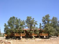
[6] Main residence |
Location, Access
& Maps
Please click on any of the maps
for a larger view
|
|
|
|
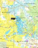
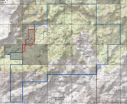
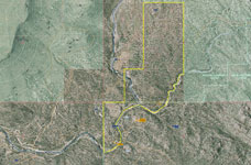
Location |
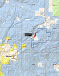
Neighborhood |
Topography map |
Aerial map
|
The Wildhorse Ranch is located in Yavapai County in central Arizona. It is on Camp Wood Road 7 miles northeast of Bagdad. Phoenix is 130 miles southwest and Prescott is 67 miles to the east.
Description
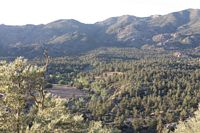
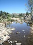
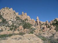
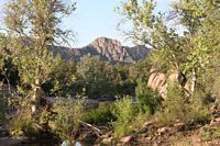
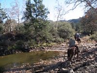
The Ranch lies in a scenic basin surrounded on the north, south, and east by mountains. The deeded land is strategically located on the west side of the basin controlling access into the interior of the property. Boulder Creek runs along the western side and thru the deeded land. This is a perennial creek with classic riparian vegetation.
Land Tenure
Tenure |
Acres |
| Deeded |
160 |
| Arizona State Grazing Lease |
6,701 |
| Total |
6,861 |
Carrying Capacity
State Grazing lease 104 head yearlong.
Improvements
- Residence - 1,352 sq. ft. Log construction; two bedroom, kitchen/dining great room, 2 baths, covered deck on 3 sides; back porch. Constructed in 2008.
- Other buildings include horse barn, storage shed, well house, and generator shed.
Water
Surface water rights from Boulder Creek for 50 acre feet per annum. Domestic water provided by a well. Livestock water provided by wells, springs, and Boulder Creek.
Vegetation, Elevation & Climate
The ranch is in the pinion pine-juniper vegetative type. Primary vegetation consists of pinion pine and juniper trees, mountain laurel, oak brush, service berry, buckwheat, juajilla, and cliff rose. Grasses include bluestem, tobosa, threeawns, needlegrass, sideoats grama. Vegetation along Boulder Creek consists of classic riparian plant community including sycamore, desert willow, cottonwood, and ash trees.
The elevation varies from 4,241 feet along Boulder Creek and at the building site to 5,600 feet in the mountains on the northern edge.
Weather records at Bagdad, elevation 3,712, indicate average annual precipitation of 13.44 inches. Mean maximum July temperature is 96.5 degrees and mean minimum January temperature is 33.1 degrees.
Bagdad
Services include Bashas grocery, restaurants, gas, EMT, motel, Elementary and High School, 18 hole golf course, County maintained general aviation airport (4,550 ft. runway).
Utilities
Solar system with generator backup. Fiber optic cable, cell phone/booster at the residence.
Price
$1,500,000
Printable
Brochure
 Please click here to download (about 2
MB) a printable brochure in Adobe Acrobat format. If you get frustrated
trying to make this work on your computer, don't hesitate to ask us
to mail you a printed and bound brochure instead. Please click here to download (about 2
MB) a printable brochure in Adobe Acrobat format. If you get frustrated
trying to make this work on your computer, don't hesitate to ask us
to mail you a printed and bound brochure instead.
Contact
Offered
for sale exclusively by:
Paul Groseta
Office: (928) 634-8110, Cell (928) 853-8369
- and -
Con Englehorn
Phone: (602) 258-1647, Cell (602) 206-1224
Email: info@headquarterswest.com
Disclaimer:
This information was obtained from sources deemed to be reliable but
is not guaranteed by the Broker. Prospective buyers should check all
the facts to their satisfaction. The property is subject to prior
sale, price change, or withdrawal.
|